While rereading the Silmarillion, I've been having some fun contrasting maps of Middle-Earth during different ages (found just by Googling.)
I noticed something odd. Consider this map of the First Age:
First Age Map http://www.elvenesse.net/maps/Arda_FirstAge.gif
One can see the ruins of Utumno in the middle of the Iron Mountains in the north.
Now take a look at this map of the Second Age:
Second Age Map http://www.tolkiensite.narod.ru/maps/second_age/the_second_age_of_arda.gif
Here Beleriand has sunk into the sea, but one can still trace the line of the Iron Mountains, with a hill in the north of Eriador roughly in the same location as Utumno, east of the Ice Bay.
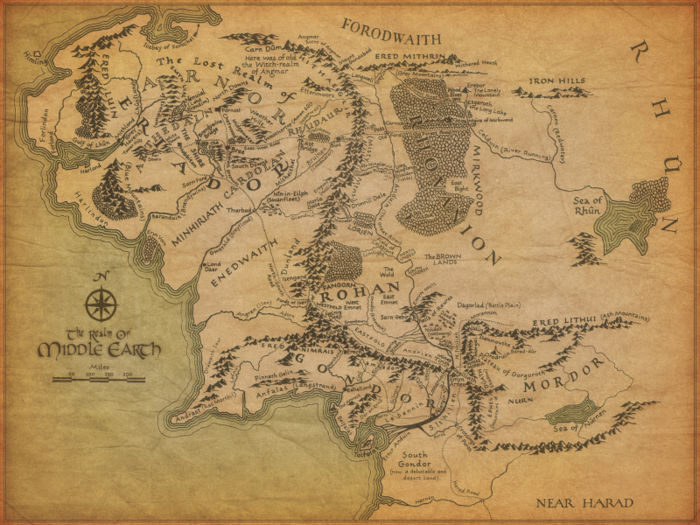
Now compare that spot with a map from the Third Age:
That hill appears to be the site of Carn Dum, the capital of Angmar.
My question, with a few follow-ups:
- Did JRRT or CT ever indicate in writing that these sites were geographically close?
- If so was the proximity intentional?
- Does anyone recognize the first two maps or can say anything about their authenticity (or lack of)?

